
Volcán de Fuego, continued to erupt, sending ash, lava, and volcanic mudflows down its slopes
2026, August 5
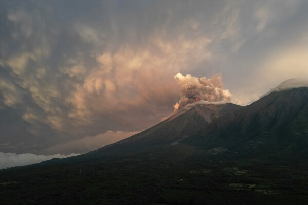
Volcán de Fuego, continued to erupt, sending ash, lava, and volcanic mudflows down its slopes
2026, August 5
Guatemala
Guatemala remains on high alert after Volcán de Fuego, one of Central America's most active volcanoes, continued to erupt, sending ash, lava, and volcanic mudflows (lahars) down its slopes. Authorities have evacuated nearby communities, with around 1,700–2,000 people now staying in temporary shelters as a precaution.The eruption began on Monday, August 4, with lava flows, towering ash clouds, and dangerous pyroclastic flows—fast-moving mixtures of hot gas, ash, and volcanic rock. Heavy rain has since mixed with volcanic debris to create lahars, which can sweep away roads, bridges, and buildings. Forecasters have warned that the next few days are especially critical if more rain falls.
Authorities have:
Evacuated residents from villages closest to the volcano.
Raised the alert level to red in the most affected departments of Sacatepéquez, Escuintla, and Chimaltenango.
Closed schools in affected areas.
Shut part of National Route 14, a key highway near the volcano.
Advised residents to wear face masks and protect water supplies from volcanic ash.
Located about 16 km (10 miles) west of the historic city of Antigua, Fuego erupts frequently and is closely monitored because of its history of devastating eruptions. Its 2018 eruption killed at least 190 people and left hundreds missing, making it Guatemala's deadliest volcanic disaster in more than a century.
Emergency officials are continuing to monitor the volcano around the clock, and evacuations are expected to remain in place until volcanic activity and the risk of mudflows subside.